Site Flight Plan Overview

A Site Flight Plan automatically generates missions suitable for capturing a structure (such as a building, a stockpile etc.) from all directions, namely from above and from all sides. This flight plan carefully combines a Top-Down Flight Plan and several Perimeter Flight Plans with different distance and gimbal setups. Example use cases include full inspections of buildings, industrial and construction sites. The guaranteed complete site coverage makes this plan the best choice when acquiring images for 3D models.
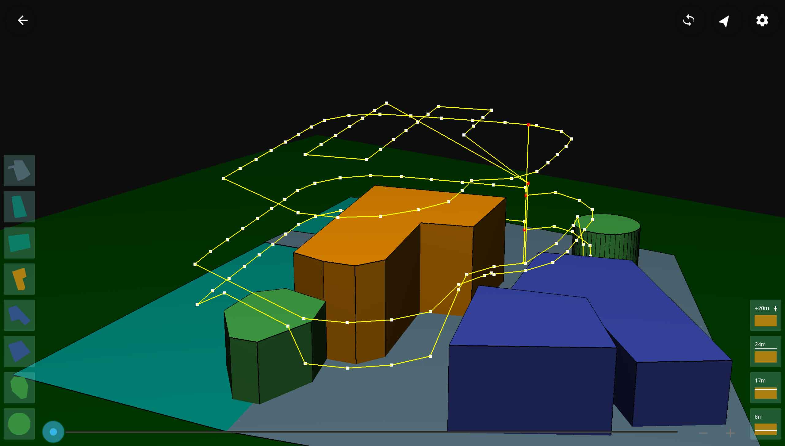
3D view of a site scan flight plan

Site Parameters

The following parameters can be used to tune a site flight plan.
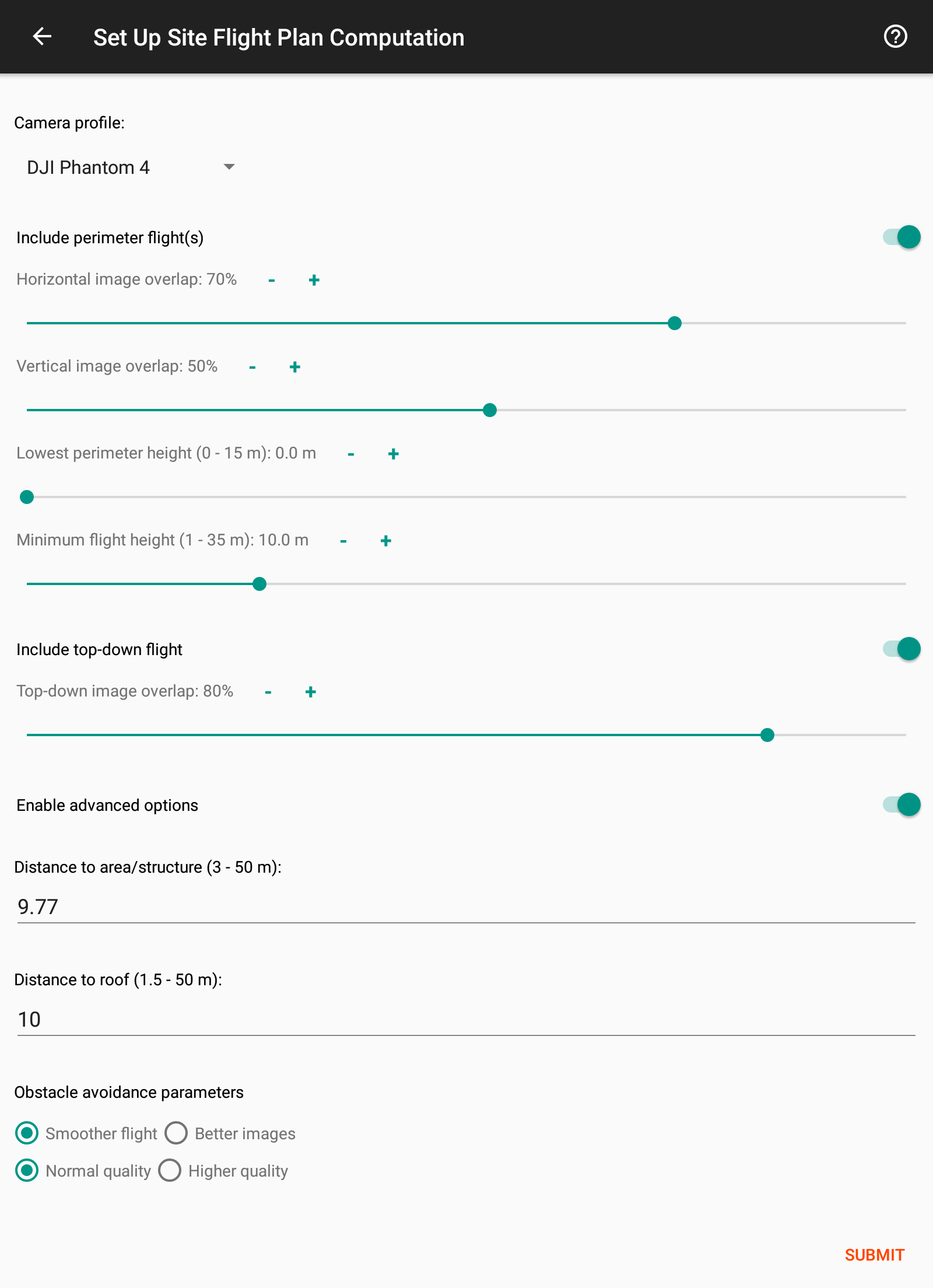
Site Scan parameters
  • Camera Profile:
    The camera or drone type that will be used to fly the plan. Every plan can be flown with any drone. This parameter helps the planner tune the plan to the attributes of the camera that you intend to use.
  • Include perimeter flight(s):
    Whether or not to include perimeter flights in the plan.
  • Horizontal overlap:
    The amount of (horizontal) overlap that successive images have along the perimeter scans. For example, 50% overlap means that half of the content of each picture appears in the next picture as well. Note that setting this parameter to a high value may result in many waypoints in each perimeter flight.
  • Vertical overlap:
    The amount of (vertical) overlap between images of a perimeter scan and the images of the perimeter scan above or below it. For example, 50% overlap means that half of the content of each picture appears in the next picture as well. Note that setting this parameter to a high value may result in many perimeter flights.
  • Lowest perimeter height:
    If the structure needs to be scanned only starting from a certain height, then adjust this value to that height. Note that the lowest perimeter height is always relative to the altitude of the lift-off location.
  • Minimum flight height:
    The minimum altitude at which the drone is allowed to fly while executing this plan. Note that this minimum altitude is always relative to the altitude of the lift-off location. Camera angles are automatically adjusted to also capture lower parts of the structure, while respecting this flight altitude restriction.
  • Include top-down flight:
    Whether or not to include a Top-Down flight in the plan.
  • Top-down image overlap:
    The overlap between images in the top-down flight in both the flight direction and the perpendicular direction.
  • Top-down image overlap:
    The overlap between images in the top-down flight in both the flight direction and the perpendicular direction.
  • Distance to area/structure:
    The horizontal distance of the waypoints from the area. The planner computes by default an optimized value that suits the shape of the area.
  • Distance to roof:
    The difference between the height of the scanned area and the flight altitude of the top-down plan.
  • Obstacle avoidance:
    When avoiding obstacles the planner can prioritize between two objectives: Smoothness of the plan and coverage of the area. These objectives often conflict each other and thus you can decide how to prioritize them. You can also choose to increase the overall quality on the expense of longer computation time.