Top Down Flight Plan Overview

A Top Down Flight Plan is suitable for capturing one or several areas from above, usually with the camera facing straight down. Example use cases include scanning terrains for mapping, inspecting rooftops and farm fields or just obtaining a bird's eye view of the landscape.
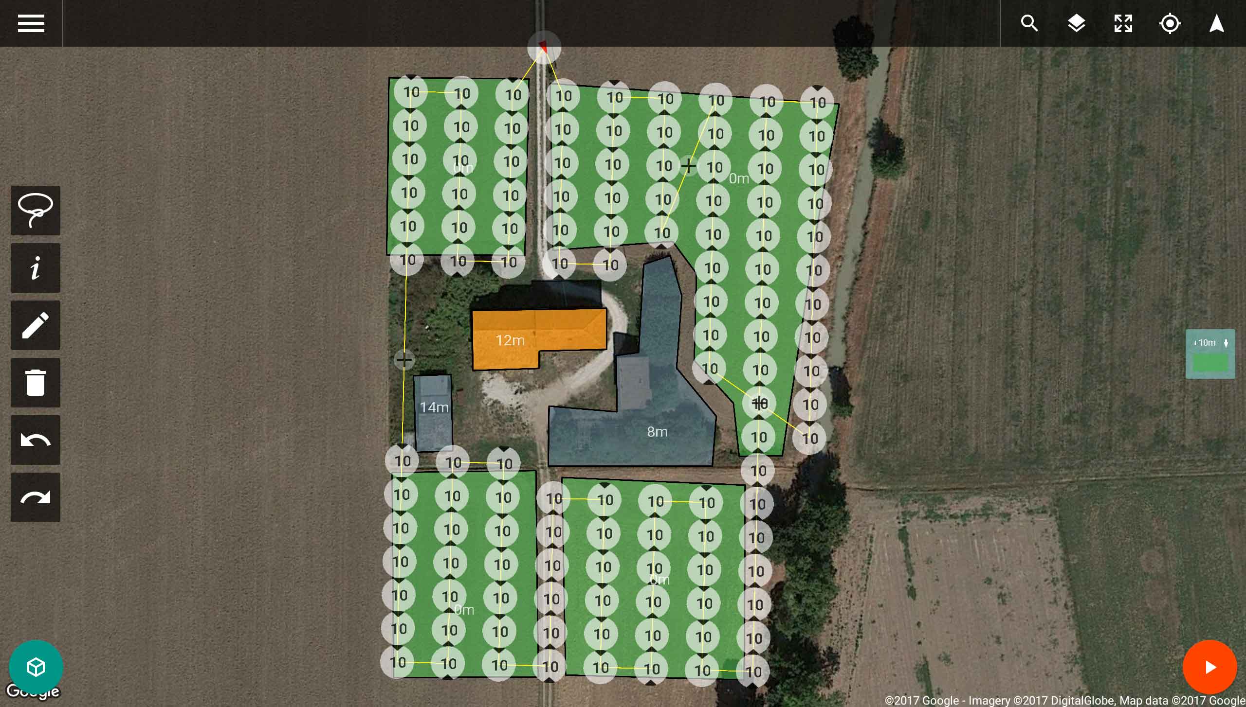
2D view of a top down scan flight plan

Top Down Parameters

The following parameters can be used to tune a top down flight plan.
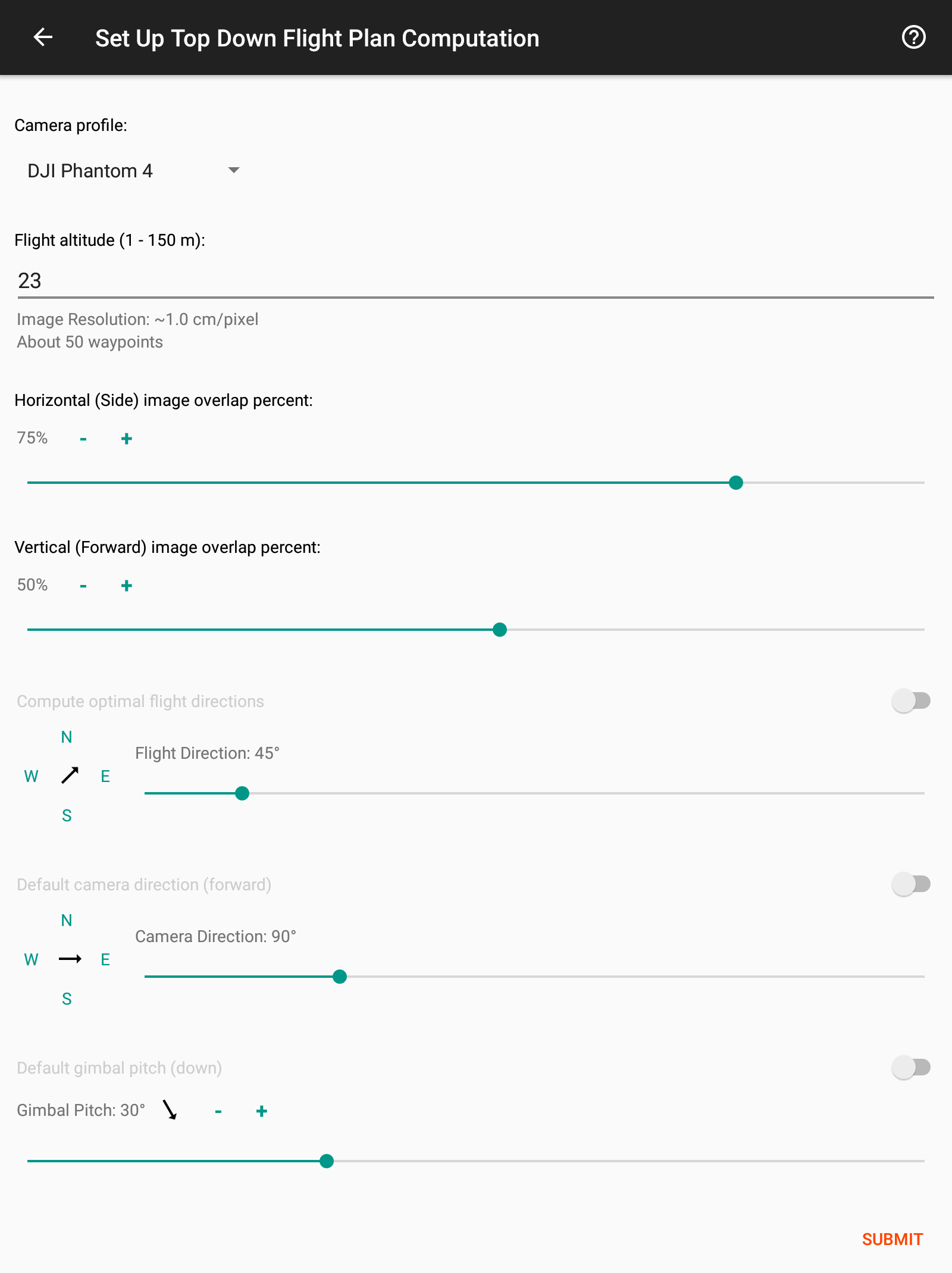
Top Down Scan parameters
  • Camera Profile:
    The camera or drone type that will be used to fly the plan. Every plan can be flown with any drone. This parameter helps the planner tune the plan to the attributes of the camera that you intend to use.
  • Flight altitude:
    The difference in altitude between the height of the area and the flight altitude of the top down flight plan. Notice that the altitude is relative to the area's height (and not the altitude of the lift-off point). For example, if the altitude is set to 10m and the scanned area is 20m high, then the plan will be 30m above the lift-off point.
    The image resolution and the estimated number of waypoints are computed to help you find the suitable flight altitude.
  • Horizontal (Side) image overlap percent:
    The percentage of overlap between neighboring images in the horizontal direction, namely perpendicular ("sideways") to the direction of flight.
  • Vertical (Forward) image overlap percent:
    The percentage of overlap between neighboring images in the (forward) direction of flight.
  • Compute optimal flight directions:
    When set, automatically computes for each area the best direction of flight that will minimize overall flight time. When manually set, all areas will be scanned with the chosen flight direction. Note that one can set for each area locally a user defined flight direction by editing the area properties. In this case you will not be able to set a global flight direction.
  • Default camera direction (forward):
    By default the direction of the camera ("yaw") is aligned with the direction of flight. You may chose to set manually a different direction.
  • Gimbal Pitch:
    Sets the pitch angle of the camera for all waypoints of the plan, where 0 corresponds to a camera facing straight down and 90 corresponds to the camera facing the horizon.